Zinnowitz - Historische Bauwerke: Unterschied zwischen den Versionen
| (17 dazwischenliegende Versionen desselben Benutzers werden nicht angezeigt) | |||
| Zeile 1: | Zeile 1: | ||
* [[Zinnowitz]] | * [[Zinnowitz]] | ||
| − | In Zusammenarbeit der Historischen Gesellschaft zu Seebad Zinnowitz auf Usedom e.V., dem Eigenbetrieb Kurverwaltung der Gemeinde Zinnowitz und der Firma Werbeservice Adrion entstanden bisher | + | In Zusammenarbeit der Historischen Gesellschaft zu Seebad Zinnowitz auf Usedom e.V., dem Eigenbetrieb Kurverwaltung der Gemeinde Zinnowitz und der Firma Werbeservice Adrion entstanden bisher 33 Informationsschilder, die über die Entstehung und Geschichte der jeweiligen Häuser und historischen Bauwerke berichten. Alle Informationsschilder sind mit einem QR-Code ausgestattet, über den man mit dem Smartphone und einem dort installierten QR-Code-Reader weiterführende Audiodateien finden kann. |
| + | |||
| + | Leider sind nicht mehr sämtliche Informationstafeln vor Ort vorhanden. Manche der Tafeln sind optisch verschlissen, wurden vom Haus-/Grundstückbesitzer entfernt oder überhaupt noch nicht installiert. Damit ist hier die einzig komplette Übersicht aller hergestellten Informationstafeln zu finden. | ||
Die Audiodateien sind in 3 Sprachen (deutsch / englisch / polnisch) verfügbar und können auch direkt auf der Internetseite der [https://www.heimatmuseum-zinnowitz.de/zinnowitzer-baudenkm%C3%A4ler/ Historischen Gesellschaft zu Seebad Zinnowitz auf Usedom e.V.] angehört werden. | Die Audiodateien sind in 3 Sprachen (deutsch / englisch / polnisch) verfügbar und können auch direkt auf der Internetseite der [https://www.heimatmuseum-zinnowitz.de/zinnowitzer-baudenkm%C3%A4ler/ Historischen Gesellschaft zu Seebad Zinnowitz auf Usedom e.V.] angehört werden. | ||
| Zeile 10: | Zeile 12: | ||
[[Datei:Zinnowitz Historische Bauwerke Übersicht.jpg|thumb|rechts|400px|Übersichtskarte]] | [[Datei:Zinnowitz Historische Bauwerke Übersicht.jpg|thumb|rechts|400px|Übersichtskarte]] | ||
| − | + | ||
| − | =Kurverwaltung= | + | ==Kurverwaltung== |
* [https://www.openstreetmap.org/?mlat=54.08059&mlon=13.91455#map=19/54.08059/13.91455 Standort auf OpenStreetMap Karte] | * [https://www.openstreetmap.org/?mlat=54.08059&mlon=13.91455#map=19/54.08059/13.91455 Standort auf OpenStreetMap Karte] | ||
| Zeile 30: | Zeile 32: | ||
<br clear=all> | <br clear=all> | ||
| − | =Dünenschloss= | + | ==Dünenschloss== |
* [https://www.openstreetmap.org/?mlat=54.08042&mlon=13.91393#map=19/54.08042/13.91393 Standort auf OpenStreetMap Karte] | * [https://www.openstreetmap.org/?mlat=54.08042&mlon=13.91393#map=19/54.08042/13.91393 Standort auf OpenStreetMap Karte] | ||
| Zeile 50: | Zeile 52: | ||
<br clear=all> | <br clear=all> | ||
| − | =Rettungsstation= | + | ==Rettungsstation== |
* [https://www.openstreetmap.org/?mlat=54.08061&mlon=13.91341#map=19/54.08061/13.91341 Standort auf OpenStreetMap Karte] | * [https://www.openstreetmap.org/?mlat=54.08061&mlon=13.91341#map=19/54.08061/13.91341 Standort auf OpenStreetMap Karte] | ||
<center> | <center> | ||
| Zeile 63: | Zeile 65: | ||
<gallery mode=packed heights=200px> | <gallery mode=packed heights=200px> | ||
| − | + | Datei:Zinnowitz-Rettungsstation 2023.jpg|im Jahre 2023 | |
</gallery> | </gallery> | ||
</center> | </center> | ||
<br clear=all> | <br clear=all> | ||
| − | =Preussenhof= | + | ==Preussenhof== |
* [https://www.openstreetmap.org/?mlat=54.08118&mlon=13.91433#map=19/54.08118/13.91433 Standort auf OpenStreetMap Karte] | * [https://www.openstreetmap.org/?mlat=54.08118&mlon=13.91433#map=19/54.08118/13.91433 Standort auf OpenStreetMap Karte] | ||
* historische Namen des Hauses: Kurhaus Strandhotel, Kurhaus Preußenhof, Heim Glück auf, Ferienhotel Glück auf, Hotel Preussenhof (aktuell 2023) | * historische Namen des Hauses: Kurhaus Strandhotel, Kurhaus Preußenhof, Heim Glück auf, Ferienhotel Glück auf, Hotel Preussenhof (aktuell 2023) | ||
| Zeile 82: | Zeile 84: | ||
<gallery mode=packed heights=200px> | <gallery mode=packed heights=200px> | ||
| − | + | Datei:Zinnowitz-Preussenhof 2023.jpg|im Jahre 2023 | |
</gallery> | </gallery> | ||
</center> | </center> | ||
<br clear=all> | <br clear=all> | ||
| − | =Palace Hotel= | + | |
| + | ==Palace Hotel== | ||
* [https://www.openstreetmap.org/?mlat=54.08158&mlon=13.91310#map=19/54.08158/13.91310 Standort auf OpenStreetMap Karte] | * [https://www.openstreetmap.org/?mlat=54.08158&mlon=13.91310#map=19/54.08158/13.91310 Standort auf OpenStreetMap Karte] | ||
* historische Namen des Hauses: Schwabe's Hotel, Heim Klement Gottwald, Ferienhotel Ostsee, Palace Hotel (aktuell 2023) | * historische Namen des Hauses: Schwabe's Hotel, Heim Klement Gottwald, Ferienhotel Ostsee, Palace Hotel (aktuell 2023) | ||
| Zeile 100: | Zeile 103: | ||
<gallery mode=packed heights=200px> | <gallery mode=packed heights=200px> | ||
| − | + | Datei:Zinnowitz-Palace Hotel 2023.jpg|im Jahre 2023 | |
</gallery> | </gallery> | ||
</center> | </center> | ||
<br clear=all> | <br clear=all> | ||
| − | =Schwalbennest= | + | ==Schwalbennest== |
* [https://www.openstreetmap.org/?mlat=54.08181&mlon=13.91255#map=19/54.08181/13.91255 Standort auf OpenStreetMap Karte] | * [https://www.openstreetmap.org/?mlat=54.08181&mlon=13.91255#map=19/54.08181/13.91255 Standort auf OpenStreetMap Karte] | ||
* historische Namen des Hauses: Schweigerts Schwalbennest, Bergmannsheim, Schwalbennest (aktuell 2023) | * historische Namen des Hauses: Schweigerts Schwalbennest, Bergmannsheim, Schwalbennest (aktuell 2023) | ||
| Zeile 124: | Zeile 127: | ||
<br clear=all> | <br clear=all> | ||
| − | =Hotel Vineta= | + | ==Hotel Vineta== |
* [https://www.openstreetmap.org/?mlat=54.08238&mlon=13.91074#map=19/54.08238/13.91074 Standort auf OpenStreetMap Karte] | * [https://www.openstreetmap.org/?mlat=54.08238&mlon=13.91074#map=19/54.08238/13.91074 Standort auf OpenStreetMap Karte] | ||
| Zeile 145: | Zeile 148: | ||
<br clear=all> | <br clear=all> | ||
| − | =Vineta-Seebrücke= | + | ==Vineta-Seebrücke== |
* [https://www.openstreetmap.org/?mlat=54.08227&mlon=13.91558#map=19/54.08227/13.91558 Standort auf OpenStreetMap Karte] | * [https://www.openstreetmap.org/?mlat=54.08227&mlon=13.91558#map=19/54.08227/13.91558 Standort auf OpenStreetMap Karte] | ||
| Zeile 160: | Zeile 163: | ||
<gallery mode=packed heights=200px> | <gallery mode=packed heights=200px> | ||
Datei:Zinnowitz Seebrücke mit Tauchgondel 2010.JPG|Seebrücke Zinnowitz mit Tauchgondel | Datei:Zinnowitz Seebrücke mit Tauchgondel 2010.JPG|Seebrücke Zinnowitz mit Tauchgondel | ||
| + | Datei:Zinnowitz-Seebrückenkopf 2023.jpg|Brückenkopf im Jahre 2023 | ||
</gallery> | </gallery> | ||
</center> | </center> | ||
<br clear=all> | <br clear=all> | ||
| − | =Haus am Meer= | + | ==Haus am Meer== |
* [https://www.openstreetmap.org/?mlat=54.07903&mlon=13.92048#map=19/54.07903/13.92048 Standort auf OpenStreetMap Karte] | * [https://www.openstreetmap.org/?mlat=54.07903&mlon=13.92048#map=19/54.07903/13.92048 Standort auf OpenStreetMap Karte] | ||
| Zeile 184: | Zeile 188: | ||
<br clear=all> | <br clear=all> | ||
| − | =Hotel Asgard= | + | ==Hotel Asgard== |
| − | * [https://www.openstreetmap.org/?mlat=54. | + | * [https://www.openstreetmap.org/?mlat=54.07940&mlon=13.91955#map=19/54.07940/13.91955 Standort auf OpenStreetMap Karte] |
* historische Namen des Hauses: Baltisches Haus, Hotel Asgard (aktuell 2023) | * historische Namen des Hauses: Baltisches Haus, Hotel Asgard (aktuell 2023) | ||
<center> | <center> | ||
| Zeile 198: | Zeile 202: | ||
<gallery mode=packed heights=200px> | <gallery mode=packed heights=200px> | ||
| − | + | Datei:Zinnowitz-Hotel Asgard 2023.jpg|im Jahre 2023 | |
</gallery> | </gallery> | ||
</center> | </center> | ||
<br clear=all> | <br clear=all> | ||
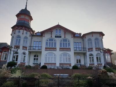
| − | =Seeschlösschen= | + | ==Seeschlösschen== |
* [https://www.openstreetmap.org/?mlat=54.08000&mlon=13.91758#map=19/54.08000/13.91758 Standort auf OpenStreetMap Karte] | * [https://www.openstreetmap.org/?mlat=54.08000&mlon=13.91758#map=19/54.08000/13.91758 Standort auf OpenStreetMap Karte] | ||
| Zeile 223: | Zeile 227: | ||
<br clear=all> | <br clear=all> | ||
| − | =Kleine Strandburg= | + | ==Kleine Strandburg== |
* [https://www.openstreetmap.org/?mlat=54.08063&mlon=13.91572#map=19/54.08063/13.91572 Standort auf OpenStreetMap Karte] | * [https://www.openstreetmap.org/?mlat=54.08063&mlon=13.91572#map=19/54.08063/13.91572 Standort auf OpenStreetMap Karte] | ||
| Zeile 245: | Zeile 249: | ||
<br clear=all> | <br clear=all> | ||
| − | =Theaterareal= | + | ==Theaterareal== |
* [https://www.openstreetmap.org/?mlat=54.07902&mlon=13.91693#map=19/54.07902/13.91693 Standort auf OpenStreetMap Karte] | * [https://www.openstreetmap.org/?mlat=54.07902&mlon=13.91693#map=19/54.07902/13.91693 Standort auf OpenStreetMap Karte] | ||
<center> | <center> | ||
| Zeile 263: | Zeile 267: | ||
<br clear=all> | <br clear=all> | ||
| − | =Theaterakademie= | + | ==Theaterakademie== |
* [https://www.openstreetmap.org/?mlat=54.07902&mlon=13.91487#map=19/54.07902/13.91487 Standort auf OpenStreetMap Karte] | * [https://www.openstreetmap.org/?mlat=54.07902&mlon=13.91487#map=19/54.07902/13.91487 Standort auf OpenStreetMap Karte] | ||
| Zeile 284: | Zeile 288: | ||
<br clear=all> | <br clear=all> | ||
| − | =Villa Gruner= | + | ==Villa Gruner== |
* [https://www.openstreetmap.org/?mlat=54.07931&mlon=13.91392#map=19/54.07931/13.91392 Standort auf OpenStreetMap Karte] | * [https://www.openstreetmap.org/?mlat=54.07931&mlon=13.91392#map=19/54.07931/13.91392 Standort auf OpenStreetMap Karte] | ||
* historische Namen des Hauses: Villa Friedel, Fremdenpension Hubertusburg, Privatkinderheim Hubertusburg, Berta-Louis-Dreyfus-Heim, Heim Paul Gruner, Pension Zur Post, Villa Gruner (aktuell 2023) | * historische Namen des Hauses: Villa Friedel, Fremdenpension Hubertusburg, Privatkinderheim Hubertusburg, Berta-Louis-Dreyfus-Heim, Heim Paul Gruner, Pension Zur Post, Villa Gruner (aktuell 2023) | ||
| Zeile 298: | Zeile 302: | ||
<gallery mode=packed heights=200px> | <gallery mode=packed heights=200px> | ||
| − | + | Datei:Zinnowitz-Villa Gruner 2023.jpg|im Jahre 2023 | |
</gallery> | </gallery> | ||
</center> | </center> | ||
<br clear=all> | <br clear=all> | ||
| − | =Tennisplatz= | + | ==Tennisplatz== |
* [https://www.openstreetmap.org/?mlat=54.07823&mlon=13.91568#map=19/54.07823/13.91568 Standort auf OpenStreetMap Karte] | * [https://www.openstreetmap.org/?mlat=54.07823&mlon=13.91568#map=19/54.07823/13.91568 Standort auf OpenStreetMap Karte] | ||
<center> | <center> | ||
| Zeile 321: | Zeile 325: | ||
<br clear=all> | <br clear=all> | ||
| − | =Waldesruh= | + | ==Waldesruh== |
* [https://www.openstreetmap.org/?mlat=54.07765&mlon=13.91745#map=18/54.07765/13.91745 Standort auf OpenStreetMap Karte] | * [https://www.openstreetmap.org/?mlat=54.07765&mlon=13.91745#map=18/54.07765/13.91745 Standort auf OpenStreetMap Karte] | ||
<center> | <center> | ||
| Zeile 339: | Zeile 343: | ||
<br clear=all> | <br clear=all> | ||
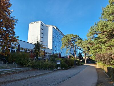
| − | =Hotel Glienberg= | + | ==Hotel Glienberg== |
* [https://www.openstreetmap.org/?mlat=54.07595&mlon=13.91843#map=18/54.07595/13.91843 Standort auf OpenStreetMap Karte] | * [https://www.openstreetmap.org/?mlat=54.07595&mlon=13.91843#map=18/54.07595/13.91843 Standort auf OpenStreetMap Karte] | ||
* historische Namen des Hauses: Kagemanns Hotel, Hotel Glienberg, Fremdenheim Glienberg, Pension Glienberg, Heim Aufbau, Hotel Am Glienberg, Parkhotel Am Glienberg (aktuell) | * historische Namen des Hauses: Kagemanns Hotel, Hotel Glienberg, Fremdenheim Glienberg, Pension Glienberg, Heim Aufbau, Hotel Am Glienberg, Parkhotel Am Glienberg (aktuell) | ||
| Zeile 358: | Zeile 362: | ||
<br clear=all> | <br clear=all> | ||
| − | =Glück auf der Höh'= | + | ==Glück auf der Höh'== |
* [https://www.openstreetmap.org/?mlat=54.07416&mlon=13.91822#map=18/54.07416/13.91822 Standort auf OpenStreetMap Karte] | * [https://www.openstreetmap.org/?mlat=54.07416&mlon=13.91822#map=18/54.07416/13.91822 Standort auf OpenStreetMap Karte] | ||
<center> | <center> | ||
| Zeile 375: | Zeile 379: | ||
<br clear=all> | <br clear=all> | ||
| − | =Villa Morgentau= | + | ==Villa Morgentau== |
* [https://www.openstreetmap.org/?mlat=54.07560&mlon=13.92055#map=19/54.07560/13.92055 Standort auf OpenStreetMap Karte] | * [https://www.openstreetmap.org/?mlat=54.07560&mlon=13.92055#map=19/54.07560/13.92055 Standort auf OpenStreetMap Karte] | ||
<center> | <center> | ||
| Zeile 393: | Zeile 397: | ||
<br clear=all> | <br clear=all> | ||
| − | =Villa Charlotte= | + | ==Villa zur See== |
| + | * [https://www.openstreetmap.org/?mlat=54.07544&mlon=13.91979#map=18/54.07544/13.91979 Standort auf OpenStreetMap Karte] | ||
| + | * historische Namen des Hauses: Villa Hohenzollern, Reschuh, Villa zur See (aktuell) | ||
| + | <center> | ||
| + | |||
| + | |||
| + | [[Datei:Zinnowitz historische Zeittafel Villa Hohenzollern.jpg|center|500px]] | ||
| + | |||
| + | |||
| + | Audiodatei in Planung | ||
| + | |||
| + | <gallery mode=packed heights=200px> | ||
| + | |||
| + | </gallery> | ||
| + | |||
| + | </center> | ||
| + | |||
| + | |||
| + | ==Villa Charlotte== | ||
* [https://www.openstreetmap.org/?mlat=54.07427&mlon=13.91954#map=19/54.07427/13.91954 Standort auf OpenStreetMap Karte] | * [https://www.openstreetmap.org/?mlat=54.07427&mlon=13.91954#map=19/54.07427/13.91954 Standort auf OpenStreetMap Karte] | ||
<center> | <center> | ||
| Zeile 411: | Zeile 433: | ||
<br clear=all> | <br clear=all> | ||
| − | =Adlershorst= | + | ==Adlershorst== |
* [https://www.openstreetmap.org/?mlat=54.07443&mlon=13.91848#map=19/54.07443/13.91848 Standort auf OpenStreetMap Karte] | * [https://www.openstreetmap.org/?mlat=54.07443&mlon=13.91848#map=19/54.07443/13.91848 Standort auf OpenStreetMap Karte] | ||
* historische Namen des Hauses: Villa Adlershorst, Haus Adlershorst (aktuell) | * historische Namen des Hauses: Villa Adlershorst, Haus Adlershorst (aktuell) | ||
| Zeile 430: | Zeile 452: | ||
<br clear=all> | <br clear=all> | ||
| − | =Steinfurth-Heim= | + | ==Steinfurth-Heim== |
* [https://www.openstreetmap.org/?mlat=54.07373&mlon=13.91777#map=19/54.07373/13.91777 Standort auf OpenStreetMap Karte] | * [https://www.openstreetmap.org/?mlat=54.07373&mlon=13.91777#map=19/54.07373/13.91777 Standort auf OpenStreetMap Karte] | ||
* historische Namen des Hauses: Hotel Belvedere und Familienpensionat, Hotel Belvedere, Maria-Heim, Kindersanatorium Erich Steinfurth, Kindergärten und Heime Haus Möwennest, (aktuell 2023 - Ruine) | * historische Namen des Hauses: Hotel Belvedere und Familienpensionat, Hotel Belvedere, Maria-Heim, Kindersanatorium Erich Steinfurth, Kindergärten und Heime Haus Möwennest, (aktuell 2023 - Ruine) | ||
| Zeile 449: | Zeile 471: | ||
<br clear=all> | <br clear=all> | ||
| − | =Evangelische Kirche= | + | ==Evangelische Kirche== |
* [https://www.openstreetmap.org/?mlat=54.07706&mlon=13.91155#map=19/54.07706/13.91155 Standort auf OpenStreetMap Karte] | * [https://www.openstreetmap.org/?mlat=54.07706&mlon=13.91155#map=19/54.07706/13.91155 Standort auf OpenStreetMap Karte] | ||
| Zeile 468: | Zeile 490: | ||
<br clear=all> | <br clear=all> | ||
| − | =Gedenkstele= | + | ==Gedenkstele== |
* [https://www.openstreetmap.org/?mlat=54.07842&mlon=13.91159#map=19/54.07842/13.91159 Standort auf OpenStreetMap Karte] | * [https://www.openstreetmap.org/?mlat=54.07842&mlon=13.91159#map=19/54.07842/13.91159 Standort auf OpenStreetMap Karte] | ||
| Zeile 487: | Zeile 509: | ||
<br clear=all> | <br clear=all> | ||
| − | =Club Kino= | + | ==Club Kino== |
* [https://www.openstreetmap.org/?mlat=54.07813&mlon=13.91089#map=19/54.07813/13.91089 Standort auf OpenStreetMap Karte] | * [https://www.openstreetmap.org/?mlat=54.07813&mlon=13.91089#map=19/54.07813/13.91089 Standort auf OpenStreetMap Karte] | ||
* historische Namen des Hauses: Kaufhaus Kagelmacher, Lichtspieltheater Regina Lichtspiele, Lichtspieltheater, Filmtheater "Theater der Freundschaft", Club Kino (aktuell 2023) | * historische Namen des Hauses: Kaufhaus Kagelmacher, Lichtspieltheater Regina Lichtspiele, Lichtspieltheater, Filmtheater "Theater der Freundschaft", Club Kino (aktuell 2023) | ||
| Zeile 501: | Zeile 523: | ||
<gallery mode=packed heights=200px> | <gallery mode=packed heights=200px> | ||
| − | + | Datei:Zinnowitz-Insel Kino 2023.jpg|im Jahre 2023 | |
</gallery> | </gallery> | ||
</center> | </center> | ||
<br clear=all> | <br clear=all> | ||
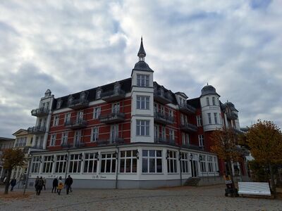
| − | =Ferienresidenz Berlin= | + | ==Ferienresidenz Berlin== |
* [https://www.openstreetmap.org/?mlat=54.07716&mlon=13.90922#map=19/54.07716/13.90922 Standort auf OpenStreetMap Karte] | * [https://www.openstreetmap.org/?mlat=54.07716&mlon=13.90922#map=19/54.07716/13.90922 Standort auf OpenStreetMap Karte] | ||
* historische Namen des Hauses: Hotel zur Strandpromenade, Hotel Strandpromenade, Bahnhofs-Hotel, Heim Berlin, Ferienhotel Berlin, Ferienresidenz Berlin (aktuell) | * historische Namen des Hauses: Hotel zur Strandpromenade, Hotel Strandpromenade, Bahnhofs-Hotel, Heim Berlin, Ferienhotel Berlin, Ferienresidenz Berlin (aktuell) | ||
| Zeile 525: | Zeile 547: | ||
<br clear=all> | <br clear=all> | ||
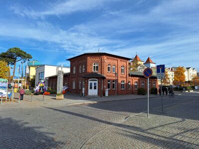
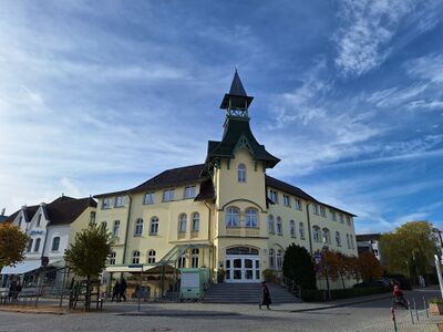
| − | =Bahnhof / Museum= | + | ==Bahnhof / Museum== |
* [https://www.openstreetmap.org/?mlat=54.07576&mlon=13.90353#map=19/54.07576/13.90353 Standort auf OpenStreetMap Karte] | * [https://www.openstreetmap.org/?mlat=54.07576&mlon=13.90353#map=19/54.07576/13.90353 Standort auf OpenStreetMap Karte] | ||
| Zeile 544: | Zeile 566: | ||
<br clear=all> | <br clear=all> | ||
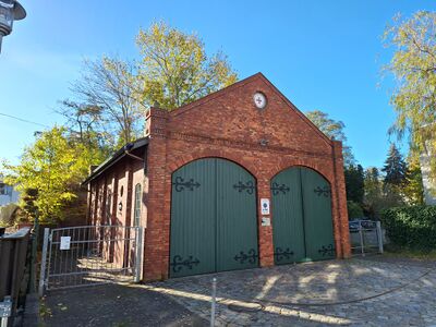
| − | =Alte Feuerwehr= | + | ==Alte Feuerwehr== |
* [https://www.openstreetmap.org/?mlat=54.07362&mlon=13.90541#map=19/54.07362/13.90541 Standort auf OpenStreetMap Karte] | * [https://www.openstreetmap.org/?mlat=54.07362&mlon=13.90541#map=19/54.07362/13.90541 Standort auf OpenStreetMap Karte] | ||
<center> | <center> | ||
| Zeile 562: | Zeile 584: | ||
<br clear=all> | <br clear=all> | ||
| − | =Das alte Dorf= | + | ==Das alte Dorf== |
| − | * [https://www.openstreetmap.org/?mlat=54. | + | * [https://www.openstreetmap.org/?mlat=54.06882&mlon=13.90244#map=19/54.06882/13.90244 Standort auf OpenStreetMap Karte] |
<center> | <center> | ||
| Zeile 580: | Zeile 602: | ||
<br clear=all> | <br clear=all> | ||
| − | = | + | ==Villa Kaiserhof== |
| − | * [ | + | * [Standort auf OpenStreetMap Karte] |
| + | * historische Namen des Hauses: Schmidts Hotel, Villa Kaiserhof, Ferienwohnungen (aktuell) | ||
<center> | <center> | ||
| − | |||
| − | |||
| − | |||
| − | |||
| − | |||
| − | |||
| − | |||
| − | |||
| − | |||
| − | |||
| − | |||
| − | |||
| − | |||
| + | [[Datei:Zinnowitz historische Zeittafel Kaiserhof.jpg|center|500px]] | ||
Audiodatei in Planung | Audiodatei in Planung | ||
| Zeile 607: | Zeile 618: | ||
</center> | </center> | ||
| − | = | + | ==Baltic== |
| − | * [Standort auf OpenStreetMap Karte] | + | * [https://www.openstreetmap.org/?mlat=54.08317&mlon=13.90829#map=19/54.08317/13.90829 Standort auf OpenStreetMap Karte] |
| − | * historische Namen des Hauses: | + | * historische Namen des Hauses: Roter Oktober, Baltic (aktuell) |
<center> | <center> | ||
| − | [[Datei:Zinnowitz historische Zeittafel | + | [[Datei:Zinnowitz historische Zeittafel Baltic.jpg|center|500px]] |
Audiodatei in Planung | Audiodatei in Planung | ||
<gallery mode=packed heights=200px> | <gallery mode=packed heights=200px> | ||
| − | + | Datei:Zinnowitz-Hotel Baltic 2023.jpg|im Jahre 2023 | |
</gallery> | </gallery> | ||
| − | |||
</center> | </center> | ||
| − | = | + | ==Fischerstrand== |
| − | * [Standort auf OpenStreetMap Karte] | + | * [https://www.openstreetmap.org/?mlat=54.07871&mlon=13.92298#map=19/54.07871/13.92298 Standort auf OpenStreetMap Karte] |
| − | |||
<center> | <center> | ||
| − | + | in Planung | |
| − | |||
| − | |||
| − | |||
| − | |||
<gallery mode=packed heights=200px> | <gallery mode=packed heights=200px> | ||
Aktuelle Version vom 24. Dezember 2023, 11:28 Uhr
In Zusammenarbeit der Historischen Gesellschaft zu Seebad Zinnowitz auf Usedom e.V., dem Eigenbetrieb Kurverwaltung der Gemeinde Zinnowitz und der Firma Werbeservice Adrion entstanden bisher 33 Informationsschilder, die über die Entstehung und Geschichte der jeweiligen Häuser und historischen Bauwerke berichten. Alle Informationsschilder sind mit einem QR-Code ausgestattet, über den man mit dem Smartphone und einem dort installierten QR-Code-Reader weiterführende Audiodateien finden kann.
Leider sind nicht mehr sämtliche Informationstafeln vor Ort vorhanden. Manche der Tafeln sind optisch verschlissen, wurden vom Haus-/Grundstückbesitzer entfernt oder überhaupt noch nicht installiert. Damit ist hier die einzig komplette Übersicht aller hergestellten Informationstafeln zu finden.
Die Audiodateien sind in 3 Sprachen (deutsch / englisch / polnisch) verfügbar und können auch direkt auf der Internetseite der Historischen Gesellschaft zu Seebad Zinnowitz auf Usedom e.V. angehört werden.
Die deutschen Audiodateien können jetzt auch hier angehört werden.

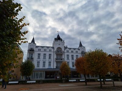
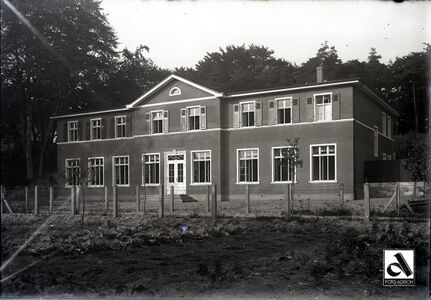
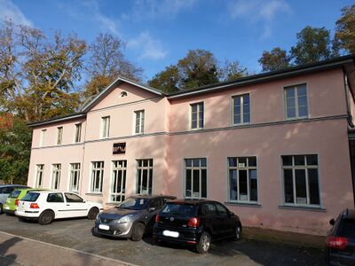
Kurverwaltung

Audiodatei abspielen
im Jahr 2023

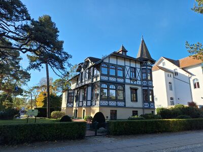
Dünenschloss
- Standort auf OpenStreetMap Karte
- historische Namen des Hauses: Dünenschloß, Heim Ernst Schneller, Pension Usedom, Dünenschloss (aktuell 2023)

Audiodatei abspielen
im Jahr 2023

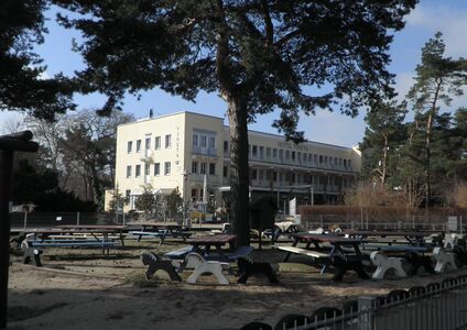
Rettungsstation

Audiodatei abspielen
im Jahre 2023

Preussenhof
- Standort auf OpenStreetMap Karte
- historische Namen des Hauses: Kurhaus Strandhotel, Kurhaus Preußenhof, Heim Glück auf, Ferienhotel Glück auf, Hotel Preussenhof (aktuell 2023)

Audiodatei abspielen
im Jahre 2023

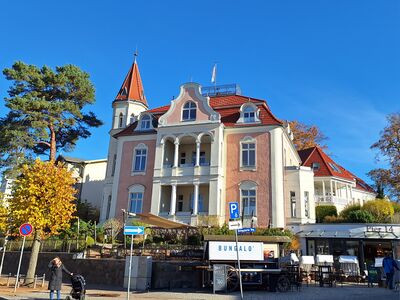
Palace Hotel
- Standort auf OpenStreetMap Karte
- historische Namen des Hauses: Schwabe's Hotel, Heim Klement Gottwald, Ferienhotel Ostsee, Palace Hotel (aktuell 2023)

Audiodatei abspielen
im Jahre 2023

Schwalbennest
- Standort auf OpenStreetMap Karte
- historische Namen des Hauses: Schweigerts Schwalbennest, Bergmannsheim, Schwalbennest (aktuell 2023)

Audiodatei abspielen
im Jahre 2023

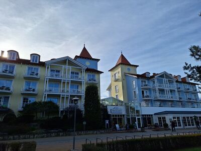
Hotel Vineta
- Standort auf OpenStreetMap Karte
- historische Namen des Hauses: Heim Ernst-Thälmann, Pension Vineta, Hotel Vineta (aktuell 2023)

Audiodatei abspielen
Hotel Vineta
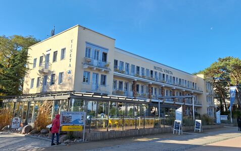
im Jahre 2023


Vineta-Seebrücke

Audiodatei abspielen
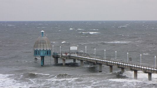
Seebrücke Zinnowitz mit Tauchgondel
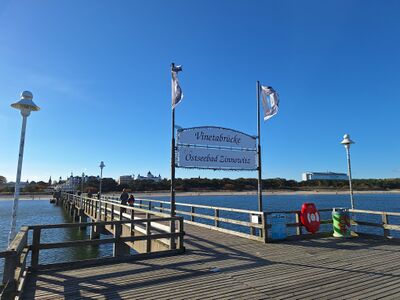
Brückenkopf im Jahre 2023


Haus am Meer
- Standort auf OpenStreetMap Karte
- historische Namen des Hauses: Villa Ramm, Haus am Meer (aktuell 2023)

Audiodatei abspielen
im Jahr 2023

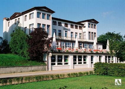
Hotel Asgard
- Standort auf OpenStreetMap Karte
- historische Namen des Hauses: Baltisches Haus, Hotel Asgard (aktuell 2023)

Audiodatei abspielen
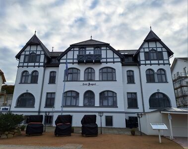
im Jahre 2023

Seeschlösschen
- Standort auf OpenStreetMap Karte
- historische Namen des Hauses: Villa Seeschlößchen, Pension Seeschlößchen, Heim Fritz Heckert, Aparthotel Seeschlößchen (aktuell 2023)

Audiodatei abspielen
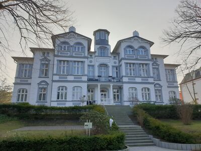
im Jahr 2023

Kleine Strandburg
- Standort auf OpenStreetMap Karte
- historische Namen des Hauses: Hotel und Pension Fortuna, Richters Hotel, Reichsbahn-Erholungsheim, "Otto Schmirgal" Heim, Zentralhotel
- 1999 erfolgte der komplette Abriss des Gebäudes und ein Neubau entstand unter dem Namen Travel Charme Strandhotel Zinnowitz, Kleine Strandburg (aktuell 2023)

Audiodatei abspielen
Zentralhotel
Kleine Strandburg im Jahr 2023


Theaterareal

Audiodatei abspielen
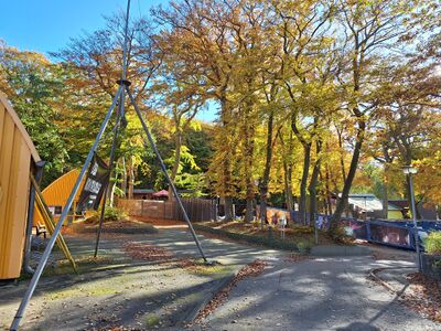
im Jahre 2023

Theaterakademie
- Standort auf OpenStreetMap Karte
- historische Namen des Hauses: Zum Wigwam, Hotel und Restaurant Wigwam, Wiener Restaurant, Wäscherei, Theaterakademie Vorpommern (aktuell 2023)

Audiodatei abspielen
im Jahr 2022


Villa Gruner
- Standort auf OpenStreetMap Karte
- historische Namen des Hauses: Villa Friedel, Fremdenpension Hubertusburg, Privatkinderheim Hubertusburg, Berta-Louis-Dreyfus-Heim, Heim Paul Gruner, Pension Zur Post, Villa Gruner (aktuell 2023)

Audiodatei abspielen
im Jahre 2023

Tennisplatz

Audiodatei abspielen
Waldesruh

Audiodatei abspielen
Hotel Glienberg
- Standort auf OpenStreetMap Karte
- historische Namen des Hauses: Kagemanns Hotel, Hotel Glienberg, Fremdenheim Glienberg, Pension Glienberg, Heim Aufbau, Hotel Am Glienberg, Parkhotel Am Glienberg (aktuell)

Audiodatei abspielen
Glück auf der Höh'

Audiodatei in Planung
Villa Morgentau

Audiodatei abspielen
Villa zur See
- Standort auf OpenStreetMap Karte
- historische Namen des Hauses: Villa Hohenzollern, Reschuh, Villa zur See (aktuell)

Audiodatei in Planung
Villa Charlotte

Audiodatei abspielen
Adlershorst
- Standort auf OpenStreetMap Karte
- historische Namen des Hauses: Villa Adlershorst, Haus Adlershorst (aktuell)

Audiodatei abspielen
Steinfurth-Heim
- Standort auf OpenStreetMap Karte
- historische Namen des Hauses: Hotel Belvedere und Familienpensionat, Hotel Belvedere, Maria-Heim, Kindersanatorium Erich Steinfurth, Kindergärten und Heime Haus Möwennest, (aktuell 2023 - Ruine)

Audiodatei abspielen
Evangelische Kirche

Audiodatei abspielen
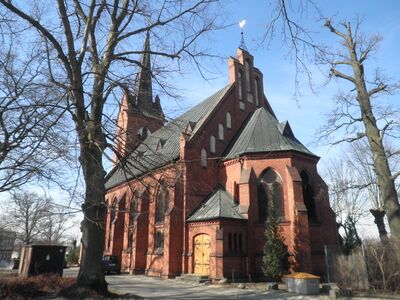
Ev. Kirche von Zinnowitz

Gedenkstele

Audiodatei abspielen
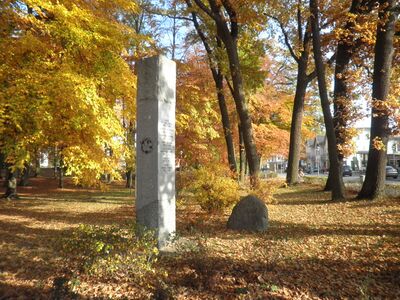
Zinnowitz Kurpark Stele

Club Kino
- Standort auf OpenStreetMap Karte
- historische Namen des Hauses: Kaufhaus Kagelmacher, Lichtspieltheater Regina Lichtspiele, Lichtspieltheater, Filmtheater "Theater der Freundschaft", Club Kino (aktuell 2023)

Audiodatei abspielen
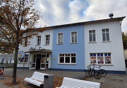
im Jahre 2023

Ferienresidenz Berlin
- Standort auf OpenStreetMap Karte
- historische Namen des Hauses: Hotel zur Strandpromenade, Hotel Strandpromenade, Bahnhofs-Hotel, Heim Berlin, Ferienhotel Berlin, Ferienresidenz Berlin (aktuell)

Audiodatei abspielen
Bahnhof / Museum

Audiodatei abspielen
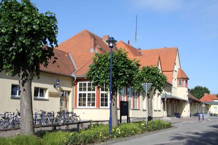
im Jahr 2022

Alte Feuerwehr

Audiodatei abspielen
Das alte Dorf

Audiodatei abspielen
Villa Kaiserhof
- [Standort auf OpenStreetMap Karte]
- historische Namen des Hauses: Schmidts Hotel, Villa Kaiserhof, Ferienwohnungen (aktuell)

Audiodatei in Planung
Baltic
- Standort auf OpenStreetMap Karte
- historische Namen des Hauses: Roter Oktober, Baltic (aktuell)

Audiodatei in Planung
im Jahre 2023

Fischerstrand
in Planung