Zinnowitz - Historische Bauwerke: Unterschied zwischen den Versionen
Keine Bearbeitungszusammenfassung |
|||
| (70 dazwischenliegende Versionen von 2 Benutzern werden nicht angezeigt) | |||
| Zeile 1: | Zeile 1: | ||
* [[Zinnowitz]] | * [[Zinnowitz]] | ||
In Zusammenarbeit der Historischen Gesellschaft zu Seebad Zinnowitz auf Usedom e.V., dem Eigenbetrieb Kurverwaltung der Gemeinde Zinnowitz und der Firma Werbeservice Adrion entstanden bisher | In Zusammenarbeit der Historischen Gesellschaft zu Seebad Zinnowitz auf Usedom e.V., dem Eigenbetrieb Kurverwaltung der Gemeinde Zinnowitz und der Firma Werbeservice Adrion entstanden bisher 37 Informationsschilder, die über die Entstehung und Geschichte der jeweiligen Häuser und historischen Bauwerke berichten. Alle Informationsschilder sind mit einem QR-Code ausgestattet, über den man mit dem Smartphone und einem dort installierten QR-Code-Reader weiterführende Audiodateien finden kann. | ||
Leider sind nicht mehr sämtliche Informationstafeln vor Ort vorhanden. Manche der Tafeln sind optisch verschlissen, wurden vom Haus-/Grundstückbesitzer entfernt oder überhaupt noch nicht installiert. Damit ist hier die einzig komplette Übersicht aller hergestellten Informationstafeln zu finden. | |||
Die Audiodateien sind in 3 Sprachen (deutsch / englisch / polnisch) verfügbar und können auch direkt auf der Internetseite der [https://www.heimatmuseum-zinnowitz.de/zinnowitzer-baudenkm%C3%A4ler/ Historischen Gesellschaft zu Seebad Zinnowitz auf Usedom e.V.] angehört werden. | Die Audiodateien sind in 3 Sprachen (deutsch / englisch / polnisch) verfügbar und können auch direkt auf der Internetseite der [https://www.heimatmuseum-zinnowitz.de/zinnowitzer-baudenkm%C3%A4ler/ Historischen Gesellschaft zu Seebad Zinnowitz auf Usedom e.V.] angehört werden. | ||
Die deutschen Audiodateien können jetzt auch hier angehört werden. | Die deutschen Audiodateien können jetzt auch hier angehört werden. | ||
---------------- | |||
<center> | |||
'''Interaktive Karte''' | |||
<html> | |||
<iframe style="width: 850px; height: 600px; border: 0;" allowfullscreen allow="geolocation" src="//umap.openstreetmap.de/de/map/interaktive-karte-von-zinnowitz-historische-bauwer_145587?scaleControl=false&miniMap=false&scrollWheelZoom=false&zoomControl=true&editMode=disabled&moreControl=true&searchControl=null&tilelayersControl=null&embedControl=null&datalayersControl=true&onLoadPanel=none&captionBar=false&captionMenus=true#15/54.076425/13.914957"></iframe><p><a href="//umap.openstreetmap.de/de/map/interaktive-karte-von-zinnowitz-historische-bauwer_145587?scaleControl=false&miniMap=false&scrollWheelZoom=true&zoomControl=true&editMode=disabled&moreControl=true&searchControl=null&tilelayersControl=null&embedControl=null&datalayersControl=true&onLoadPanel=none&captionBar=false&captionMenus=true#15/54.076425/13.914957">Vollbildanzeige</a></p> | |||
</html> | |||
</center> | |||
[[Datei:Zinnowitz Historische Bauwerke Übersicht.jpg|thumb|rechts|450px|Übersichtskarte von Eigenbetrieb Kurverwaltung der Gemeinde Ostseebad Zinnowitz]] | |||
==Kurverwaltung== | |||
=Kurverwaltung= | |||
* [https://www.openstreetmap.org/?mlat=54.08059&mlon=13.91455#map=19/54.08059/13.91455 Standort auf OpenStreetMap Karte] | * [https://www.openstreetmap.org/?mlat=54.08059&mlon=13.91455#map=19/54.08059/13.91455 Standort auf OpenStreetMap Karte] | ||
| Zeile 30: | Zeile 36: | ||
<br clear=all> | <br clear=all> | ||
=Dünenschloss= | ==Dünenschloss== | ||
* [https://www.openstreetmap.org/?mlat=54.08042&mlon=13.91393#map=19/54.08042/13.91393 Standort auf OpenStreetMap Karte] | * [https://www.openstreetmap.org/?mlat=54.08042&mlon=13.91393#map=19/54.08042/13.91393 Standort auf OpenStreetMap Karte] | ||
| Zeile 50: | Zeile 56: | ||
<br clear=all> | <br clear=all> | ||
=Rettungsstation= | ==Rettungsstation== | ||
* [https://www.openstreetmap.org/?mlat=54.08061&mlon=13.91341#map=19/54.08061/13.91341 Standort auf OpenStreetMap Karte] | * [https://www.openstreetmap.org/?mlat=54.08061&mlon=13.91341#map=19/54.08061/13.91341 Standort auf OpenStreetMap Karte] | ||
<center> | <center> | ||
| Zeile 68: | Zeile 74: | ||
<br clear=all> | <br clear=all> | ||
=Preussenhof= | ==Preussenhof== | ||
* [https://www.openstreetmap.org/?mlat=54.08118&mlon=13.91433#map=19/54.08118/13.91433 Standort auf OpenStreetMap Karte] | * [https://www.openstreetmap.org/?mlat=54.08118&mlon=13.91433#map=19/54.08118/13.91433 Standort auf OpenStreetMap Karte] | ||
* historische Namen des Hauses: Kurhaus Strandhotel, Kurhaus Preußenhof, Heim Glück auf, Ferienhotel Glück auf, Hotel Preussenhof (aktuell 2023) | * historische Namen des Hauses: Kurhaus Strandhotel, Kurhaus Preußenhof, Heim Glück auf, Ferienhotel Glück auf, Hotel Preussenhof (aktuell 2023) | ||
| Zeile 87: | Zeile 93: | ||
<br clear=all> | <br clear=all> | ||
=Palace Hotel= | ==Palace Hotel== | ||
* [https://www.openstreetmap.org/?mlat=54.08158&mlon=13.91310#map=19/54.08158/13.91310 Standort auf OpenStreetMap Karte] | * [https://www.openstreetmap.org/?mlat=54.08158&mlon=13.91310#map=19/54.08158/13.91310 Standort auf OpenStreetMap Karte] | ||
* historische Namen des Hauses: Schwabe's Hotel, Heim Klement Gottwald, Ferienhotel Ostsee, Palace Hotel (aktuell 2023) | * historische Namen des Hauses: Schwabe's Hotel, Heim Klement Gottwald, Ferienhotel Ostsee, Palace Hotel (aktuell 2023) | ||
| Zeile 106: | Zeile 112: | ||
<br clear=all> | <br clear=all> | ||
=Schwalbennest= | ==Schwalbennest== | ||
* [https://www.openstreetmap.org/?mlat=54.08181&mlon=13.91255#map=19/54.08181/13.91255 Standort auf OpenStreetMap Karte] | * [https://www.openstreetmap.org/?mlat=54.08181&mlon=13.91255#map=19/54.08181/13.91255 Standort auf OpenStreetMap Karte] | ||
* historische Namen des Hauses: Schweigerts Schwalbennest, Bergmannsheim, Schwalbennest (aktuell 2023) | * historische Namen des Hauses: Schweigerts Schwalbennest, Bergmannsheim, Schwalbennest (aktuell 2023) | ||
| Zeile 125: | Zeile 131: | ||
<br clear=all> | <br clear=all> | ||
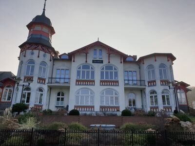
=Hotel Vineta= | ==Hotel Vineta== | ||
* [https://www.openstreetmap.org/?mlat=54.08238&mlon=13.91074#map=19/54.08238/13.91074 Standort auf OpenStreetMap Karte] | * [https://www.openstreetmap.org/?mlat=54.08238&mlon=13.91074#map=19/54.08238/13.91074 Standort auf OpenStreetMap Karte] | ||
| Zeile 146: | Zeile 152: | ||
<br clear=all> | <br clear=all> | ||
=Vineta-Seebrücke= | ==Vineta-Seebrücke== | ||
* [https://www.openstreetmap.org/?mlat=54.08227&mlon=13.91558#map=19/54.08227/13.91558 Standort auf OpenStreetMap Karte] | * [https://www.openstreetmap.org/?mlat=54.08227&mlon=13.91558#map=19/54.08227/13.91558 Standort auf OpenStreetMap Karte] | ||
| Zeile 166: | Zeile 172: | ||
<br clear=all> | <br clear=all> | ||
=Haus am Meer= | ==Haus am Meer== | ||
* [https://www.openstreetmap.org/?mlat=54.07903&mlon=13.92048#map=19/54.07903/13.92048 Standort auf OpenStreetMap Karte] | * [https://www.openstreetmap.org/?mlat=54.07903&mlon=13.92048#map=19/54.07903/13.92048 Standort auf OpenStreetMap Karte] | ||
| Zeile 186: | Zeile 192: | ||
<br clear=all> | <br clear=all> | ||
=Hotel Asgard= | ==Hotel Asgard== | ||
* [https://www.openstreetmap.org/?mlat=54. | * [https://www.openstreetmap.org/?mlat=54.07940&mlon=13.91955#map=19/54.07940/13.91955 Standort auf OpenStreetMap Karte] | ||
* historische Namen des Hauses: Baltisches Haus, Hotel Asgard (aktuell 2023) | * historische Namen des Hauses: Baltisches Haus, Hotel Asgard (aktuell 2023) | ||
<center> | <center> | ||
| Zeile 205: | Zeile 211: | ||
<br clear=all> | <br clear=all> | ||
=Seeschlösschen= | ==Seeschlösschen== | ||
* [https://www.openstreetmap.org/?mlat=54.08000&mlon=13.91758#map=19/54.08000/13.91758 Standort auf OpenStreetMap Karte] | * [https://www.openstreetmap.org/?mlat=54.08000&mlon=13.91758#map=19/54.08000/13.91758 Standort auf OpenStreetMap Karte] | ||
| Zeile 225: | Zeile 231: | ||
<br clear=all> | <br clear=all> | ||
=Kleine Strandburg= | ==Kleine Strandburg== | ||
* [https://www.openstreetmap.org/?mlat=54.08063&mlon=13.91572#map=19/54.08063/13.91572 Standort auf OpenStreetMap Karte] | * [https://www.openstreetmap.org/?mlat=54.08063&mlon=13.91572#map=19/54.08063/13.91572 Standort auf OpenStreetMap Karte] | ||
| Zeile 247: | Zeile 253: | ||
<br clear=all> | <br clear=all> | ||
=Theaterareal= | ==Theaterareal== | ||
* [https://www.openstreetmap.org/?mlat=54.07902&mlon=13.91693#map=19/54.07902/13.91693 Standort auf OpenStreetMap Karte] | * [https://www.openstreetmap.org/?mlat=54.07902&mlon=13.91693#map=19/54.07902/13.91693 Standort auf OpenStreetMap Karte] | ||
<center> | <center> | ||
| Zeile 265: | Zeile 271: | ||
<br clear=all> | <br clear=all> | ||
=Theaterakademie= | ==Theaterakademie== | ||
* [https://www.openstreetmap.org/?mlat=54.07902&mlon=13.91487#map=19/54.07902/13.91487 Standort auf OpenStreetMap Karte] | * [https://www.openstreetmap.org/?mlat=54.07902&mlon=13.91487#map=19/54.07902/13.91487 Standort auf OpenStreetMap Karte] | ||
| Zeile 286: | Zeile 292: | ||
<br clear=all> | <br clear=all> | ||
=Villa Gruner= | ==Villa Gruner== | ||
* [https://www.openstreetmap.org/?mlat=54.07931&mlon=13.91392#map=19/54.07931/13.91392 Standort auf OpenStreetMap Karte] | * [https://www.openstreetmap.org/?mlat=54.07931&mlon=13.91392#map=19/54.07931/13.91392 Standort auf OpenStreetMap Karte] | ||
* historische Namen des Hauses: Villa Friedel, Fremdenpension Hubertusburg, Privatkinderheim Hubertusburg, Berta-Louis-Dreyfus-Heim, Heim Paul Gruner, Pension Zur Post, Villa Gruner (aktuell 2023) | * historische Namen des Hauses: Villa Friedel, Fremdenpension Hubertusburg, Privatkinderheim Hubertusburg, Berta-Louis-Dreyfus-Heim, Heim Paul Gruner, Pension Zur Post, Villa Gruner (aktuell 2023) | ||
| Zeile 305: | Zeile 311: | ||
<br clear=all> | <br clear=all> | ||
=Tennisplatz= | ==Tennisplatz== | ||
* [https://www.openstreetmap.org/?mlat=54.07823&mlon=13.91568#map=19/54.07823/13.91568 Standort auf OpenStreetMap Karte] | * [https://www.openstreetmap.org/?mlat=54.07823&mlon=13.91568#map=19/54.07823/13.91568 Standort auf OpenStreetMap Karte] | ||
<center> | <center> | ||
| Zeile 318: | Zeile 324: | ||
<gallery mode=packed heights=200px> | <gallery mode=packed heights=200px> | ||
Datei:Zinnowitz-Tennisplatz 07.2024.jpg|im Jahre 2024 | |||
</gallery> | </gallery> | ||
</center> | </center> | ||
<br clear=all> | <br clear=all> | ||
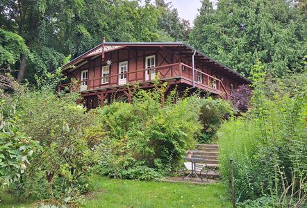
=Waldesruh= | ==Waldesruh== | ||
* [https://www.openstreetmap.org/?mlat=54.07765&mlon=13.91745#map=18/54.07765/13.91745 Standort auf OpenStreetMap Karte] | * [https://www.openstreetmap.org/?mlat=54.07765&mlon=13.91745#map=18/54.07765/13.91745 Standort auf OpenStreetMap Karte] | ||
<center> | <center> | ||
| Zeile 336: | Zeile 342: | ||
<gallery mode=packed heights=200px> | <gallery mode=packed heights=200px> | ||
Datei:Zinnowitz-Waldesruh 2024 .jpg|im Jahre 2024 | |||
</gallery> | </gallery> | ||
</center> | </center> | ||
<br clear=all> | <br clear=all> | ||
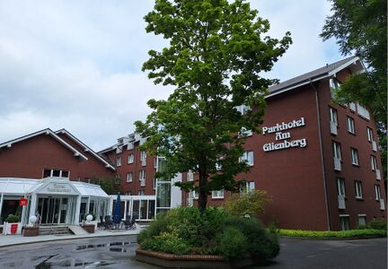
=Hotel Glienberg= | ==Hotel Glienberg== | ||
* [https://www.openstreetmap.org/?mlat=54.07595&mlon=13.91843#map=18/54.07595/13.91843 Standort auf OpenStreetMap Karte] | * [https://www.openstreetmap.org/?mlat=54.07595&mlon=13.91843#map=18/54.07595/13.91843 Standort auf OpenStreetMap Karte] | ||
* historische Namen des Hauses: Kagemanns Hotel, Hotel Glienberg, Fremdenheim Glienberg, Pension Glienberg, Heim Aufbau, Hotel Am Glienberg, Parkhotel Am Glienberg (aktuell) | * historische Namen des Hauses: Kagemanns Hotel, Hotel Glienberg, Fremdenheim Glienberg, Pension Glienberg, Heim Aufbau, Hotel Am Glienberg, Parkhotel Am Glienberg (aktuell) | ||
| Zeile 355: | Zeile 361: | ||
<gallery mode=packed heights=200px> | <gallery mode=packed heights=200px> | ||
Datei:Zinnowitz-Hotel Glienberg 2024.jpg|im Jahre 2024 | |||
</gallery> | </gallery> | ||
</center> | </center> | ||
<br clear=all> | <br clear=all> | ||
=Glück auf der Höh | ==Glück auf der Höh== | ||
* [https://www.openstreetmap.org/?mlat=54.07416&mlon=13.91822#map=18/54.07416/13.91822 Standort auf OpenStreetMap Karte] | * [https://www.openstreetmap.org/?mlat=54.07416&mlon=13.91822#map=18/54.07416/13.91822 Standort auf OpenStreetMap Karte] | ||
<center> | <center> | ||
| Zeile 368: | Zeile 374: | ||
[[Datei:Zinnowitz-Glück auf der Höh audio deutsch.mp3]] | |||
<gallery mode=packed heights=200px> | <gallery mode=packed heights=200px> | ||
Datei:Zinnowitz-Glück auf der Höh 2024.jpg|im Jahre 2024 | |||
</gallery> | </gallery> | ||
</center> | </center> | ||
<br clear=all> | <br clear=all> | ||
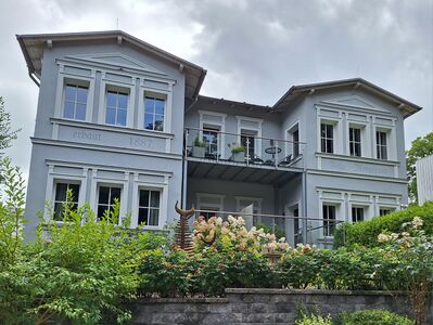
=Villa Morgentau= | ==Villa Morgentau== | ||
* [https://www.openstreetmap.org/?mlat=54.07560&mlon=13.92055#map=19/54.07560/13.92055 Standort auf OpenStreetMap Karte] | * [https://www.openstreetmap.org/?mlat=54.07560&mlon=13.92055#map=19/54.07560/13.92055 Standort auf OpenStreetMap Karte] | ||
<center> | <center> | ||
| Zeile 390: | Zeile 396: | ||
<gallery mode=packed heights=200px> | <gallery mode=packed heights=200px> | ||
Datei:Zinnowitz-Villa Morgentau 2024.jpg|im Jahre 2024 | |||
</gallery> | |||
</center> | |||
<br clear=all> | |||
==Villa zur See== | |||
* [https://www.openstreetmap.org/?mlat=54.07544&mlon=13.91979#map=18/54.07544/13.91979 Standort auf OpenStreetMap Karte] | |||
* historische Namen des Hauses: Villa Hohenzollern, Reschuh, Villa zur See (aktuell) | |||
<center> | |||
[[Datei:Zinnowitz historische Zeittafel Villa Hohenzollern.jpg|center|500px]] | |||
Audiodatei in Planung | |||
<gallery mode=packed heights=200px> | |||
Datei:Zinnowitz-Villa zur See 2024.jpg|im Jahre 2024 | |||
</gallery> | </gallery> | ||
</center> | </center> | ||
=Villa Charlotte= | ==Villa Viking (vormals Charlotte)== | ||
* [https://www.openstreetmap.org/?mlat=54.07427&mlon=13.91954#map=19/54.07427/13.91954 Standort auf OpenStreetMap Karte] | * [https://www.openstreetmap.org/?mlat=54.07427&mlon=13.91954#map=19/54.07427/13.91954 Standort auf OpenStreetMap Karte] | ||
<center> | <center> | ||
| Zeile 408: | Zeile 431: | ||
<gallery mode=packed heights=200px> | <gallery mode=packed heights=200px> | ||
Datei:Zinnowit-Viking 2024.jpg|im Jahre 2024 | |||
</gallery> | </gallery> | ||
</center> | </center> | ||
<br clear=all> | <br clear=all> | ||
=Adlershorst= | ==Adlershorst== | ||
* [https://www.openstreetmap.org/?mlat=54.07443&mlon=13.91848#map=19/54.07443/13.91848 Standort auf OpenStreetMap Karte] | * [https://www.openstreetmap.org/?mlat=54.07443&mlon=13.91848#map=19/54.07443/13.91848 Standort auf OpenStreetMap Karte] | ||
* historische Namen des Hauses: Villa Adlershorst, Haus Adlershorst (aktuell) | * historische Namen des Hauses: Villa Adlershorst, Haus Adlershorst (aktuell) | ||
| Zeile 427: | Zeile 450: | ||
<gallery mode=packed heights=200px> | <gallery mode=packed heights=200px> | ||
Datei:Zinnowitz - Adlershorst 2024.jpg|im Jahre 2024 | |||
</gallery> | </gallery> | ||
</center> | </center> | ||
<br clear=all> | <br clear=all> | ||
=Steinfurth-Heim= | ==Steinfurth-Heim== | ||
* [https://www.openstreetmap.org/?mlat=54.07373&mlon=13.91777#map=19/54.07373/13.91777 Standort auf OpenStreetMap Karte] | * [https://www.openstreetmap.org/?mlat=54.07373&mlon=13.91777#map=19/54.07373/13.91777 Standort auf OpenStreetMap Karte] | ||
* historische Namen des Hauses: Hotel Belvedere und Familienpensionat, Hotel Belvedere, Maria-Heim, Kindersanatorium Erich Steinfurth, Kindergärten und Heime Haus Möwennest, (aktuell 2023 - Ruine) | * historische Namen des Hauses: Hotel Belvedere und Familienpensionat, Hotel Belvedere, Maria-Heim, Kindersanatorium Erich Steinfurth, Kindergärten und Heime Haus Möwennest, (aktuell 2023 - Ruine) | ||
| Zeile 446: | Zeile 469: | ||
<gallery mode=packed heights=200px> | <gallery mode=packed heights=200px> | ||
Datei:Zinnowitz-Steinfurth Heim 2024.jpg|im Jahre 2024 | |||
</gallery> | </gallery> | ||
</center> | </center> | ||
<br clear=all> | <br clear=all> | ||
=Evangelische Kirche= | ==Evangelische Kirche== | ||
* [https://www.openstreetmap.org/?mlat=54.07706&mlon=13.91155#map=19/54.07706/13.91155 Standort auf OpenStreetMap Karte] | * [https://www.openstreetmap.org/?mlat=54.07706&mlon=13.91155#map=19/54.07706/13.91155 Standort auf OpenStreetMap Karte] | ||
| Zeile 470: | Zeile 493: | ||
<br clear=all> | <br clear=all> | ||
=Gedenkstele= | ==Gedenkstele== | ||
* [https://www.openstreetmap.org/?mlat=54.07842&mlon=13.91159#map=19/54.07842/13.91159 Standort auf OpenStreetMap Karte] | * [https://www.openstreetmap.org/?mlat=54.07842&mlon=13.91159#map=19/54.07842/13.91159 Standort auf OpenStreetMap Karte] | ||
| Zeile 489: | Zeile 512: | ||
<br clear=all> | <br clear=all> | ||
=Club Kino= | ==Club Kino== | ||
* [https://www.openstreetmap.org/?mlat=54.07813&mlon=13.91089#map=19/54.07813/13.91089 Standort auf OpenStreetMap Karte] | * [https://www.openstreetmap.org/?mlat=54.07813&mlon=13.91089#map=19/54.07813/13.91089 Standort auf OpenStreetMap Karte] | ||
* historische Namen des Hauses: Kaufhaus Kagelmacher, Lichtspieltheater Regina Lichtspiele, Lichtspieltheater, Filmtheater "Theater der Freundschaft", Club Kino (aktuell 2023) | * historische Namen des Hauses: Kaufhaus Kagelmacher, Lichtspieltheater Regina Lichtspiele, Lichtspieltheater, Filmtheater "Theater der Freundschaft", Club Kino (aktuell 2023) | ||
| Zeile 508: | Zeile 531: | ||
<br clear=all> | <br clear=all> | ||
=Ferienresidenz Berlin= | ==Ferienresidenz Berlin== | ||
* [https://www.openstreetmap.org/?mlat=54.07716&mlon=13.90922#map=19/54.07716/13.90922 Standort auf OpenStreetMap Karte] | * [https://www.openstreetmap.org/?mlat=54.07716&mlon=13.90922#map=19/54.07716/13.90922 Standort auf OpenStreetMap Karte] | ||
* historische Namen des Hauses: Hotel zur Strandpromenade, Hotel Strandpromenade, Bahnhofs-Hotel, Heim Berlin, Ferienhotel Berlin, Ferienresidenz Berlin (aktuell) | * historische Namen des Hauses: Hotel zur Strandpromenade, Hotel Strandpromenade, Bahnhofs-Hotel, Heim Berlin, Ferienhotel Berlin, Ferienresidenz Berlin (aktuell) | ||
| Zeile 522: | Zeile 545: | ||
<gallery mode=packed heights=200px> | <gallery mode=packed heights=200px> | ||
Datei:Zinnowitz-Ferienresidenz Berlin 2024.jpg|im Jahre 2024 | |||
</gallery> | </gallery> | ||
</center> | </center> | ||
<br clear=all> | <br clear=all> | ||
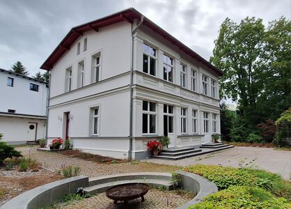
=Bahnhof / Museum= | ==Bahnhof / Museum== | ||
* [https://www.openstreetmap.org/?mlat=54.07576&mlon=13.90353#map=19/54.07576/13.90353 Standort auf OpenStreetMap Karte] | * [https://www.openstreetmap.org/?mlat=54.07576&mlon=13.90353#map=19/54.07576/13.90353 Standort auf OpenStreetMap Karte] | ||
| Zeile 546: | Zeile 569: | ||
<br clear=all> | <br clear=all> | ||
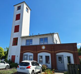
=Alte Feuerwehr= | ==Alte Feuerwehr== | ||
* [https://www.openstreetmap.org/?mlat=54.07362&mlon=13.90541#map=19/54.07362/13.90541 Standort auf OpenStreetMap Karte] | * [https://www.openstreetmap.org/?mlat=54.07362&mlon=13.90541#map=19/54.07362/13.90541 Standort auf OpenStreetMap Karte] | ||
<center> | <center> | ||
| Zeile 559: | Zeile 582: | ||
<gallery mode=packed heights=200px> | <gallery mode=packed heights=200px> | ||
Datei:Zinnowitz-Alte Feuerwehr 2024.jpg|im Jahre 2024 | |||
</gallery> | </gallery> | ||
</center> | </center> | ||
<br clear=all> | <br clear=all> | ||
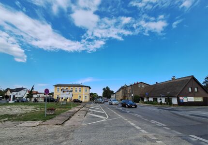
=Das alte Dorf= | ==Das alte Dorf== | ||
* [https://www.openstreetmap.org/?mlat=54. | * [https://www.openstreetmap.org/?mlat=54.06882&mlon=13.90244#map=19/54.06882/13.90244 Standort auf OpenStreetMap Karte] | ||
<center> | <center> | ||
| Zeile 577: | Zeile 600: | ||
<gallery mode=packed heights=200px> | <gallery mode=packed heights=200px> | ||
Datei:Zinnowitz-Alte Dorf 2024.jpg|im Jahre 2024 | |||
</gallery> | |||
</center> | |||
<br clear=all> | |||
==Villa Kaiserhof== | |||
* [https://www.openstreetmap.org/?mlat=54.075976&mlon=13.915067#map=19/54.075976/13.915067 Standort auf OpenStreetMap Karte] | |||
* historische Namen des Hauses: Schmidts Hotel, Villa Kaiserhof, Ferienwohnungen (aktuell) | |||
<center> | |||
[[Datei:Zinnowitz historische Zeittafel Kaiserhof.jpg|center|500px]] | |||
Audiodatei in Planung | |||
<gallery mode=packed heights=200px> | |||
Datei:Zinnowitz-Villa Kaiserhof 2024.jpg|im Jahre 2024 | |||
</gallery> | </gallery> | ||
</center> | </center> | ||
<br clear=all> | <br clear=all> | ||
= | ==Baltic== | ||
* [https://www.openstreetmap.org/?mlat=54. | * [https://www.openstreetmap.org/?mlat=54.08317&mlon=13.90829#map=19/54.08317/13.90829 Standort auf OpenStreetMap Karte] | ||
* historische Namen des Hauses: Roter Oktober, Baltic (aktuell) | |||
<center> | <center> | ||
in Planung | |||
[[Datei:Zinnowitz historische Zeittafel Baltic.jpg|center|500px]] | |||
Audiodatei in Planung | |||
<gallery mode=packed heights=200px> | <gallery mode=packed heights=200px> | ||
Datei:Zinnowitz-Hotel Baltic 2023.jpg|im Jahre 2023 | |||
</gallery> | |||
</center> | |||
<br clear=all> | |||
==Villen Wald und See== | |||
* [https://www.openstreetmap.org/?mlat=54.078485&mlon=13.922269#map=19/54.078485/13.922269 Standort auf OpenStreetMap Karte] | |||
<center> | |||
[[Datei:Zinnowitz-Tafeln-Villen Wald und See Stand 14.01.2025.jpg|center|500px]] | |||
[[Datei:Zinnowitz-Tafeln 2025-Wald und See Audio deutsch.mp3]] | |||
Audiodatei abspielen | |||
<gallery mode=packed heights=200px> | |||
Datei:Zinnowitz-Villen Wald und See-2024.jpg|im Jahre 2024 | |||
</gallery> | </gallery> | ||
</center> | </center> | ||
<br clear=all> | |||
==Hotel zur Ostsee und Villa Fahl== | |||
* [https://www.openstreetmap.org/?mlat=54.078709&mlon=13.921569#map=19/54.078709/13.921569 Standort auf OpenStreetMap Karte] | |||
<center> | <center> | ||
[[Datei:Zinnowitz | [[Datei:Zinnowitz-Tafeln-Hotel zur Ostsee Stand 14.01.2025.jpg|center|500px]] | ||
[[Datei:Zinnowitz-Tafeln 2025-Hotel zur Ostsee Audio deutsch.mp3]] | |||
Audiodatei abspielen | |||
<gallery mode=packed heights=150px> | |||
Datei:Zinnowitz-Hotel zur Ostsee und Villa Fahl-1-2023.jpg|im Jahre 2023 | |||
Datei:Zinnowitz-Hotel zur Ostsee und Villa Fahl-2-2023.jpg|im Jahre 2023 | |||
</gallery> | </gallery> | ||
</center> | |||
<br clear=all> | |||
==Elli-Voigt-Haus== | |||
* [https://www.openstreetmap.org/?mlat=54.082130&mlon=13.898877#map=19/54.082130/13.898877 Standort auf OpenStreetMap Karte] | |||
<center> | <center> | ||
[[Datei:Zinnowitz | [[Datei:Zinnowitz-Tafeln-Elli Voigt Haus Stand 14.01.2025.jpg|center|500px]] | ||
[[Datei:Zinnowitz-Tafeln 2025-elli-voigt-audio-deutsch.mp3]] | |||
Audiodatei | Audiodatei abspielen | ||
<gallery mode=packed heights=200px> | <gallery mode=packed heights=200px> | ||
Zinnowitz-Elli-Vogt-Heim-1.jpg|im Jahre 2024 | |||
</gallery> | </gallery> | ||
</center> | |||
<br clear=all> | |||
==Villa Erika von Brockdorff== | |||
* [https://www.openstreetmap.org/?mlat=54.075921&mlon=13.916899#map=19/54.075921/13.916899 Standort auf OpenStreetMap Karte] | |||
<center> | <center> | ||
[[Datei:Zinnowitz | [[Datei:Zinnowitz-Tafeln-Villa Erika von Brockdorff Stand 14.01.2025.jpg|center|500px]] | ||
[[Datei:Zinnowitz-Tafeln 2025-Villa brockdorff audio deutsch.mp3]] | |||
Audiodatei abspielen | |||
<gallery mode=packed heights=200px> | |||
Datei:Zinnowitz-Villa Erika von Brockdorff-2024.jpg|im Jahre 2024 | |||
</gallery> | |||
</center> | |||
<br clear=all> | |||
==neuer Standort== | |||
* [https://www.openstreetmap.org/?mlat=54.07871&mlon=13.92298#map=19/54.07871/13.92298 Standort auf OpenStreetMap Karte] | |||
<center> | |||
in Planung | |||
<gallery mode=packed heights=200px> | <gallery mode=packed heights=200px> | ||
</gallery> | </gallery> | ||
</center> | </center> | ||
<br clear=all> | |||
[[Kategorie:Bauwerke]] | |||
Aktuelle Version vom 7. Juli 2026, 16:54 Uhr
In Zusammenarbeit der Historischen Gesellschaft zu Seebad Zinnowitz auf Usedom e.V., dem Eigenbetrieb Kurverwaltung der Gemeinde Zinnowitz und der Firma Werbeservice Adrion entstanden bisher 37 Informationsschilder, die über die Entstehung und Geschichte der jeweiligen Häuser und historischen Bauwerke berichten. Alle Informationsschilder sind mit einem QR-Code ausgestattet, über den man mit dem Smartphone und einem dort installierten QR-Code-Reader weiterführende Audiodateien finden kann.
Leider sind nicht mehr sämtliche Informationstafeln vor Ort vorhanden. Manche der Tafeln sind optisch verschlissen, wurden vom Haus-/Grundstückbesitzer entfernt oder überhaupt noch nicht installiert. Damit ist hier die einzig komplette Übersicht aller hergestellten Informationstafeln zu finden.
Die Audiodateien sind in 3 Sprachen (deutsch / englisch / polnisch) verfügbar und können auch direkt auf der Internetseite der Historischen Gesellschaft zu Seebad Zinnowitz auf Usedom e.V. angehört werden.
Die deutschen Audiodateien können jetzt auch hier angehört werden.
Interaktive Karte

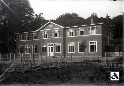
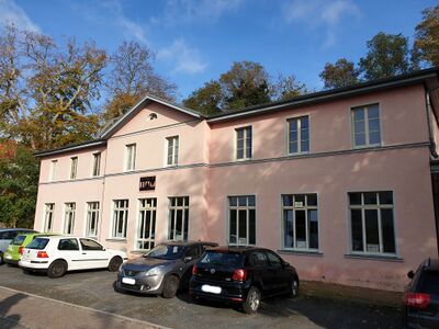
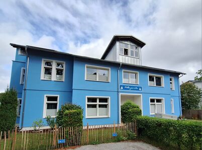
Kurverwaltung

Audiodatei abspielen
-
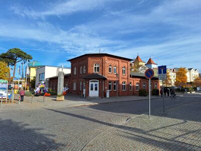 im Jahr 2023

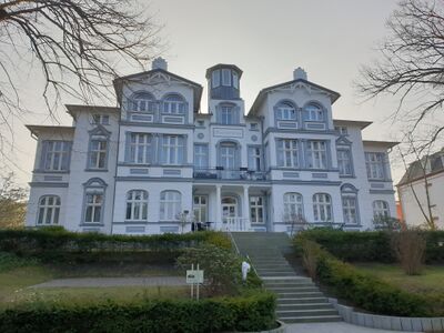
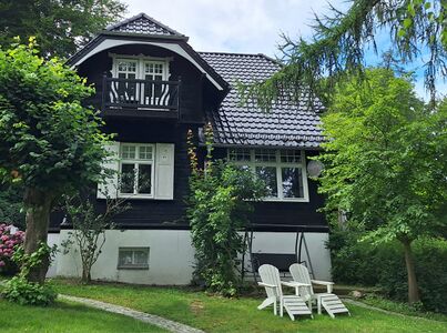
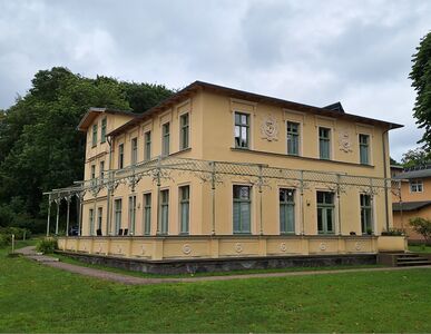
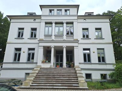
Dünenschloss
- Standort auf OpenStreetMap Karte
- historische Namen des Hauses: Dünenschloß, Heim Ernst Schneller, Pension Usedom, Dünenschloss (aktuell 2023)

Audiodatei abspielen
-
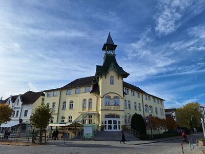 im Jahr 2023

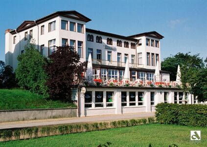
Rettungsstation

Audiodatei abspielen
-
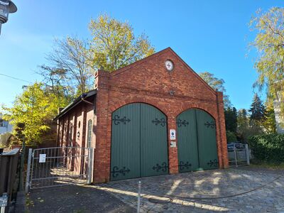 im Jahre 2023

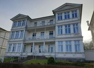
Preussenhof
- Standort auf OpenStreetMap Karte
- historische Namen des Hauses: Kurhaus Strandhotel, Kurhaus Preußenhof, Heim Glück auf, Ferienhotel Glück auf, Hotel Preussenhof (aktuell 2023)

Audiodatei abspielen
-
 im Jahre 2023

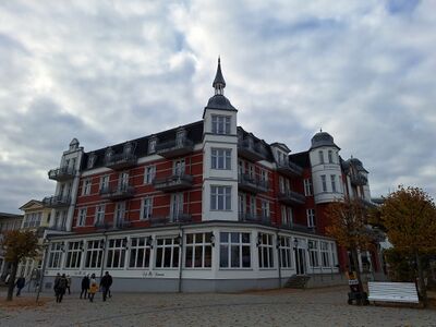
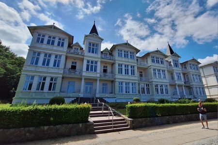
Palace Hotel
- Standort auf OpenStreetMap Karte
- historische Namen des Hauses: Schwabe's Hotel, Heim Klement Gottwald, Ferienhotel Ostsee, Palace Hotel (aktuell 2023)

Audiodatei abspielen
-
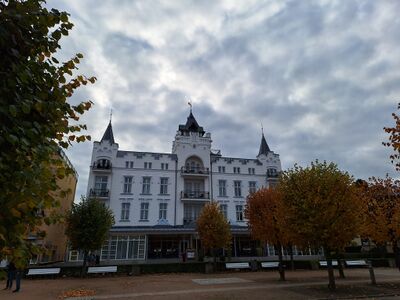 im Jahre 2023

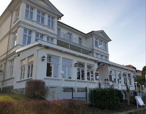
Schwalbennest
- Standort auf OpenStreetMap Karte
- historische Namen des Hauses: Schweigerts Schwalbennest, Bergmannsheim, Schwalbennest (aktuell 2023)

Audiodatei abspielen
-
 im Jahre 2023

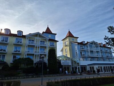
Hotel Vineta
- Standort auf OpenStreetMap Karte
- historische Namen des Hauses: Heim Ernst-Thälmann, Pension Vineta, Hotel Vineta (aktuell 2023)

Audiodatei abspielen
-
 Hotel Vineta
 -
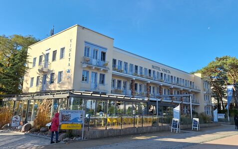 im Jahre 2023


Vineta-Seebrücke

Audiodatei abspielen
-
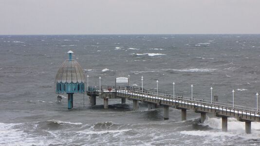 Seebrücke Zinnowitz mit Tauchgondel
 -
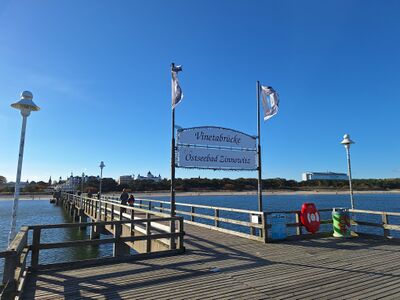 Brückenkopf im Jahre 2023


Haus am Meer
- Standort auf OpenStreetMap Karte
- historische Namen des Hauses: Villa Ramm, Haus am Meer (aktuell 2023)

Audiodatei abspielen
-
 im Jahr 2023

Hotel Asgard
- Standort auf OpenStreetMap Karte
- historische Namen des Hauses: Baltisches Haus, Hotel Asgard (aktuell 2023)

Audiodatei abspielen
-
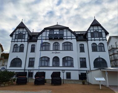 im Jahre 2023

Seeschlösschen
- Standort auf OpenStreetMap Karte
- historische Namen des Hauses: Villa Seeschlößchen, Pension Seeschlößchen, Heim Fritz Heckert, Aparthotel Seeschlößchen (aktuell 2023)

Audiodatei abspielen
-
 im Jahr 2023

Kleine Strandburg
- Standort auf OpenStreetMap Karte
- historische Namen des Hauses: Hotel und Pension Fortuna, Richters Hotel, Reichsbahn-Erholungsheim, "Otto Schmirgal" Heim, Zentralhotel
- 1999 erfolgte der komplette Abriss des Gebäudes und ein Neubau entstand unter dem Namen Travel Charme Strandhotel Zinnowitz, Kleine Strandburg (aktuell 2023)

Audiodatei abspielen
-
 Zentralhotel
 -
 Kleine Strandburg im Jahr 2023


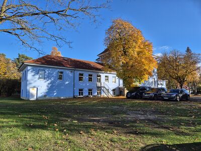
Theaterareal

Audiodatei abspielen
-
 im Jahre 2023

Theaterakademie
- Standort auf OpenStreetMap Karte
- historische Namen des Hauses: Zum Wigwam, Hotel und Restaurant Wigwam, Wiener Restaurant, Wäscherei, Theaterakademie Vorpommern (aktuell 2023)

Audiodatei abspielen
-
-
 im Jahr 2022


Villa Gruner
- Standort auf OpenStreetMap Karte
- historische Namen des Hauses: Villa Friedel, Fremdenpension Hubertusburg, Privatkinderheim Hubertusburg, Berta-Louis-Dreyfus-Heim, Heim Paul Gruner, Pension Zur Post, Villa Gruner (aktuell 2023)

Audiodatei abspielen
-
 im Jahre 2023

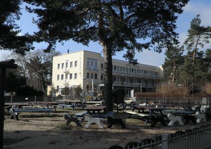
Tennisplatz

Audiodatei abspielen
-
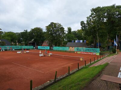 im Jahre 2024

Waldesruh

Audiodatei abspielen
-
 im Jahre 2024

Hotel Glienberg
- Standort auf OpenStreetMap Karte
- historische Namen des Hauses: Kagemanns Hotel, Hotel Glienberg, Fremdenheim Glienberg, Pension Glienberg, Heim Aufbau, Hotel Am Glienberg, Parkhotel Am Glienberg (aktuell)

Audiodatei abspielen
-
 im Jahre 2024

Glück auf der Höh

-
 im Jahre 2024

Villa Morgentau

Audiodatei abspielen
-
 im Jahre 2024

Villa zur See
- Standort auf OpenStreetMap Karte
- historische Namen des Hauses: Villa Hohenzollern, Reschuh, Villa zur See (aktuell)

Audiodatei in Planung
-
 im Jahre 2024

Villa Viking (vormals Charlotte)

Audiodatei abspielen
-
 im Jahre 2024

Adlershorst
- Standort auf OpenStreetMap Karte
- historische Namen des Hauses: Villa Adlershorst, Haus Adlershorst (aktuell)

Audiodatei abspielen
-
 im Jahre 2024

Steinfurth-Heim
- Standort auf OpenStreetMap Karte
- historische Namen des Hauses: Hotel Belvedere und Familienpensionat, Hotel Belvedere, Maria-Heim, Kindersanatorium Erich Steinfurth, Kindergärten und Heime Haus Möwennest, (aktuell 2023 - Ruine)

Audiodatei abspielen
-
 im Jahre 2024

Evangelische Kirche

Audiodatei abspielen
-
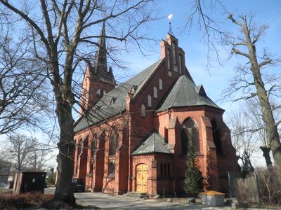 Ev. Kirche von Zinnowitz

Gedenkstele

Audiodatei abspielen
-
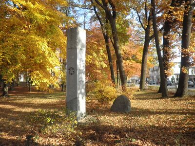 Zinnowitz Kurpark Stele

Club Kino
- Standort auf OpenStreetMap Karte
- historische Namen des Hauses: Kaufhaus Kagelmacher, Lichtspieltheater Regina Lichtspiele, Lichtspieltheater, Filmtheater "Theater der Freundschaft", Club Kino (aktuell 2023)

Audiodatei abspielen
-
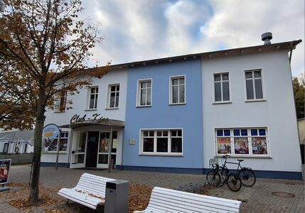 im Jahre 2023

Ferienresidenz Berlin
- Standort auf OpenStreetMap Karte
- historische Namen des Hauses: Hotel zur Strandpromenade, Hotel Strandpromenade, Bahnhofs-Hotel, Heim Berlin, Ferienhotel Berlin, Ferienresidenz Berlin (aktuell)

Audiodatei abspielen
-
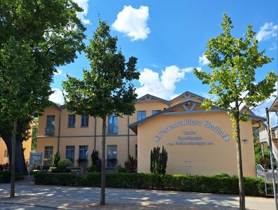 im Jahre 2024

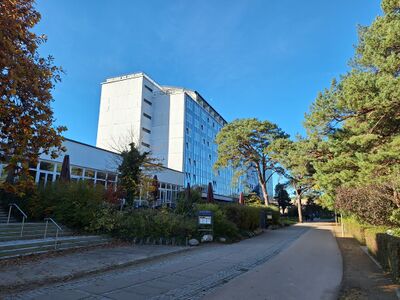
Bahnhof / Museum

Audiodatei abspielen
-
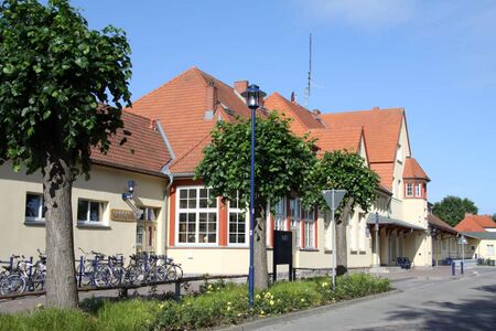 im Jahr 2022

Alte Feuerwehr

Audiodatei abspielen
-
 im Jahre 2024

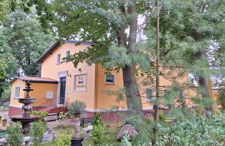
Das alte Dorf

Audiodatei abspielen
-
 im Jahre 2024

Villa Kaiserhof
- Standort auf OpenStreetMap Karte
- historische Namen des Hauses: Schmidts Hotel, Villa Kaiserhof, Ferienwohnungen (aktuell)

Audiodatei in Planung
-
 im Jahre 2024

Baltic
- Standort auf OpenStreetMap Karte
- historische Namen des Hauses: Roter Oktober, Baltic (aktuell)

Audiodatei in Planung
-
 im Jahre 2023

Villen Wald und See

Audiodatei abspielen
-
 im Jahre 2024

Hotel zur Ostsee und Villa Fahl

Audiodatei abspielen
-
 im Jahre 2023
 -
 im Jahre 2023


Elli-Voigt-Haus

Audiodatei abspielen
-
 im Jahre 2024

Villa Erika von Brockdorff

Audiodatei abspielen
-
 im Jahre 2024

neuer Standort
in Planung